Shopping Cart
There are no more items in your cart


Immediate shipping
6.61 €
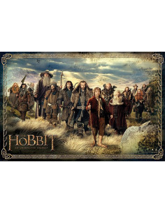
Embark on an unexpected adventure with the official "The Hobbit: An Unexpected Journey" poster! Measuring 61x91 cm, this landscape poster will immerse you in the magical world of Middle Earth every time you look at it. Why settle for a simple decoration when you can have an officially licensed piece of art that pays homage to one of the most iconic...


